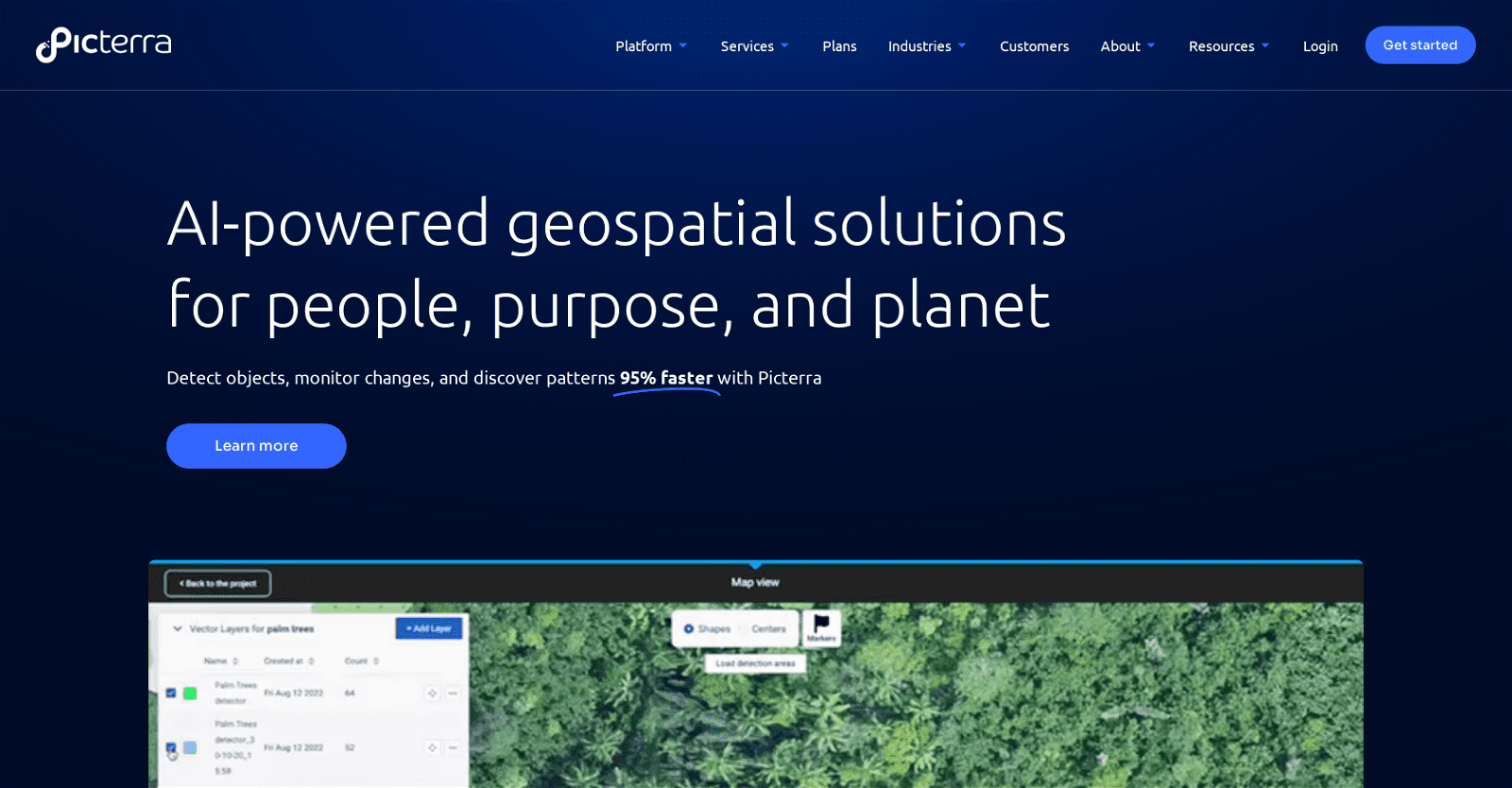
Picterra is a cloud-based platform utilizing AI for geospatial solutions, contributing to a sustainable future. Through AI capabilities, Picterra offers object detection, change monitoring, and pattern discovery features to optimize geospatial workflows and expedite decision-making.
It caters to various industries, including Forestry and Carbon Markets, Agriculture and Regenerative Farming, Mining and Quarries, Infrastructure, and FMCG & commodities.
Specific functionalities are tailored for each industry. For instance, tree detection for forestry, multi-class crop detection for agriculture, and mine expansion/deforestation detection for mining.
Customers can leverage Picterra’s platform to automate data analysis and efficiently generate insights. Their services also extend to providing professional solutions compliant with EUDR regulations.
Picterra’s application spans across multiple sectors, empowering businesses to manage and interpret their data effectively, thereby promoting sustainable action.
More details about Picterra
What are the functionalities provided by Picterra for Mining and Quarries?
For the Mining and Quarries sector, Picterra provides functionalities for mine expansion and deforestation detection. These features enable businesses to monitor changes in geographical areas around mines and quarries, helping them maintain environmental and operational standards.
What features does Picterra provide for the Forestry and Carbon Markets?
For the Forestry and Carbon Markets, Picterra provides tree detection functionality. This makes it possible to accurately monitor and analyze the forest area in an automated way, which can be critical in maintaining forest health and implementing environmental conservation measures.
Does Picterra have a free trial offer?
Yes, Picterra does offer a free trial. Businesses can try the Picterra platform for 14 days for free.
How does Picterra help businesses interpret data more effectively?
Picterra helps businesses interpret their data more effectively by providing a platform that uses AI for detailed and accurate geospatial analysis. This approach enables businesses to derive meaningful insights from their data and guides informed decision-making.